
Western Alabama – A beautiful Monday is at hand across Central Alabama with highs climbing into the upper 70s and low 80s under mostly sunny skies!
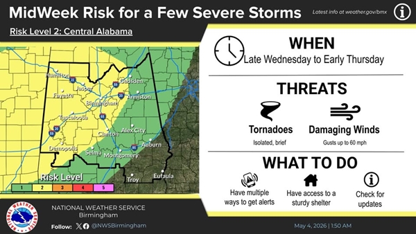
However, The National Weather Service is keeping a close eye on Wednesday night into Thursday morning. A Slight Risk (Level 2/5) for severe storms has been introduced for the western half of our coverage area – St Clair & Shelby Counties along with western Talladega County.
The primary threats will be damaging winds and isolated, brief tornadoes, developing late Wednesday night through early Thursday. Please stay weather aware!
